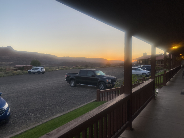
Dawn at the Rim Rock Inn, Torrey, UT.
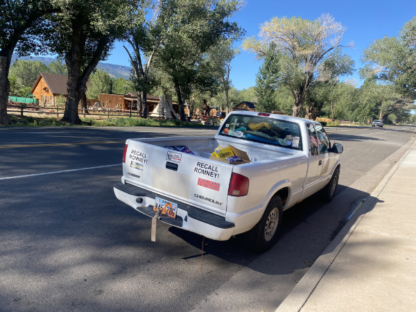
We went to the local trading post/cafe/souvenir shop for things, and this was parked outside. ::sigh:: Bless their hearts.
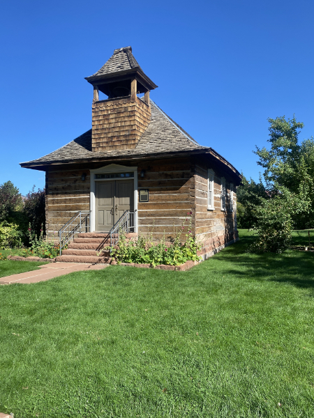
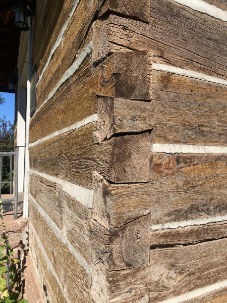
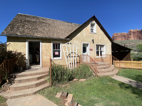
This is the Torrey Log Church and Schoolhouse. I will now copy the historic plaque for you:
The Torrey Log Church/Schoolhouse, completed in 1898, is locally significant as the first church building and the first school building in the pioneer community of Torrey, settled in the 1890s. After a new multi-use building with classrooms was built in 1917 and a new meetinghouse was constructed in 1928, the Torrey Log Church/Schoolhouse continued to be used for various religious and social functions until the 1970s.
The building is architecturally significant as one of approximately one dozen remaining Church of Jesus Christ of Latter-day Saints meetinghouses built within the initial settlement phase. It is the only known example of a log meetinghouse still standing in the state. The building is made of sawn logs joined at the corners with carefully executed half-dovetailed notching. The building was relocated approximately 100 yards to the west to make room for the expansion of the neighboring 1928 sandstone meetinghouse. The Daughters of the Utah Pioneers have restored the building and are using it as a place to hold local meetings, continuing its traditional use for religious and social functions.
The aforementioned half-dovetailed notching. Pretty impressive.
So, Capitol Reef.
No, I hadn’t heard of it either, and the young ranger at the visitors center made light of their relative invisibility vis-a-vis Zion and Arches.
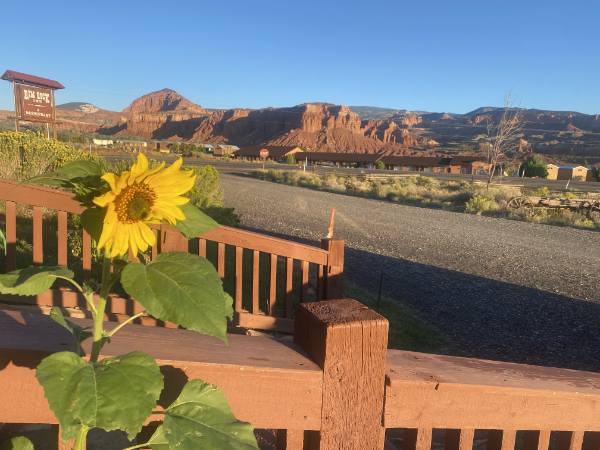
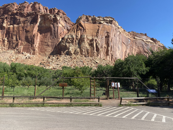
Before you even enter the park…
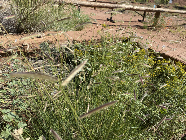
This is not a good photo, but I’ve always loved this grass, with its little flags of seeds.
Since it rained yesterday, several of the roads and hiking trails were closed due to the threat of flash floods. (This did not stop people from walking down closed roads — I mean, it’s clearly not raining, right? Wrong. (If you didn’t click that link yesterday, click it now. And don’t be stupid.))
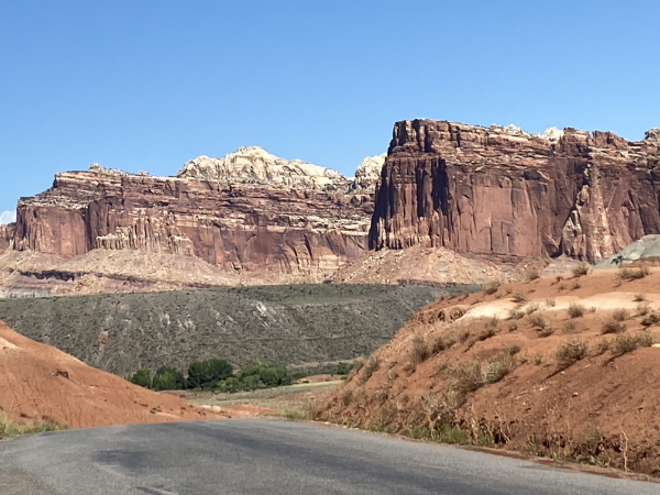
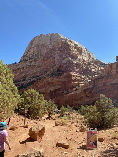
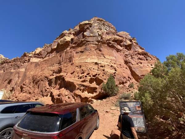
It’s bizarre how different each park is. Capitol Reef is mostly sheer cliffs rising above a settlement called Fruita; the settlers grew apples, pears, etc., and those plants are still there. For a fee, you can pick your own.
There is still a settler’s home there, the Gifford House. Much renovated over the years, of course, it’s now a gift shop/museum and snack bar, while still maintaining the feel of the home it used to be.
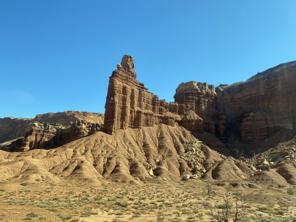
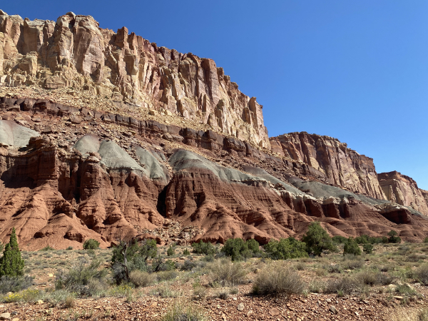
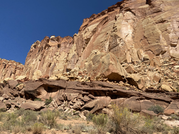
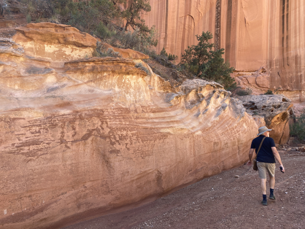
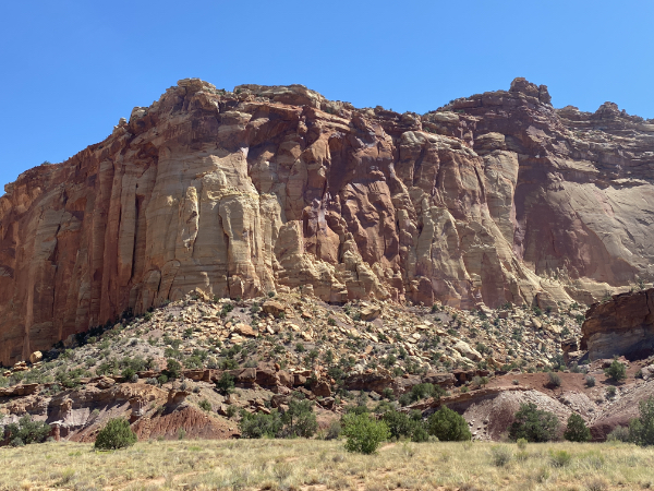
We’re going to do a lot of geology today. Since you’re at the bottom of the canyon this time, it’s easy to see the geological layers. I’m not going to try to teach you what they are; I have barely started learning myself. But you will recall from your science classes that all these layers of sedimentary rock are exactly that: sediment from oceans long gone, as the earth formed and reformed itself over the years.
Now all those ground up rocks are themselves being ground up by wind and water.
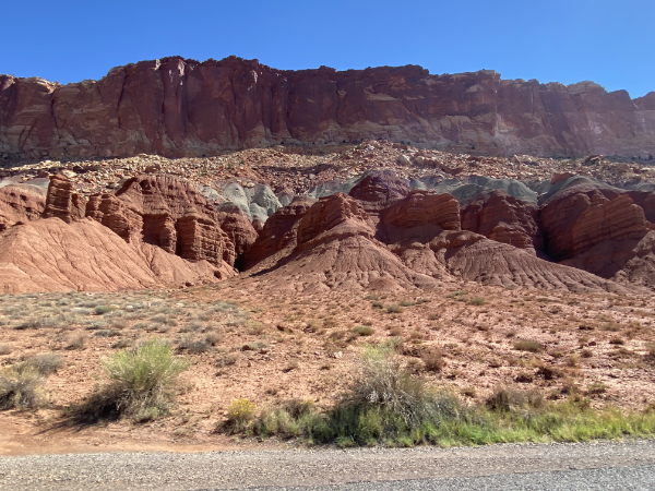
There are important facts to remember that make your mind go sproing and you go back to marveling at it all. In this next photo, for example, remember that these cliffs were part of one continent-sized plain. As tectonic forces raised that plain up, wind and water did their thing, and after millions of years of erosion…
Layers.
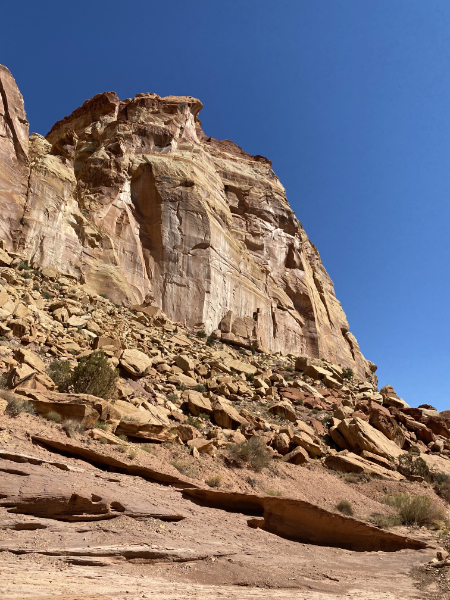
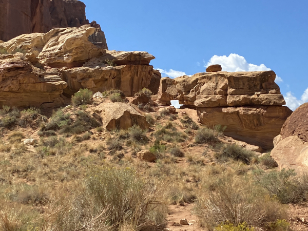
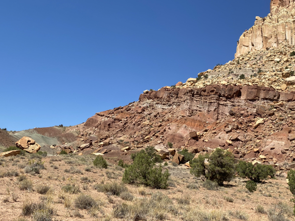
All these big boulders down here? They used to be up there. Each bit of debris you see was an event. As hard as it is to realize that this is not the way it always was, it’s true.
Not only that, but every force that created this landscape is still in operation. Boulders still fall. Water still freezes in cracks and splits rock.
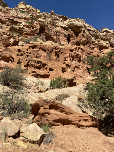
Wind still scours holes in solid rock.
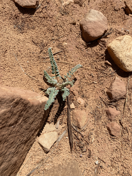
Cute plant. Not a fern, but similar.
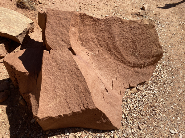
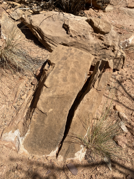
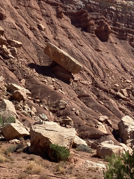
Remember, this fell from the cliff once upon a time, and relatively recently, given the sharp edges.
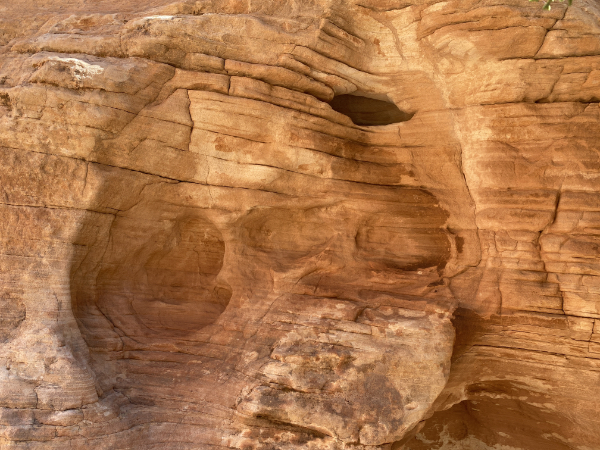
This one was amazing.
A closer look.
A rock split by ice. All those forces operating on a macro scale on the cliffs are operating on each and every rock.
See the little holes?
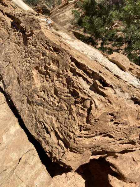
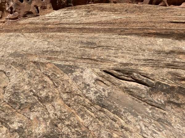
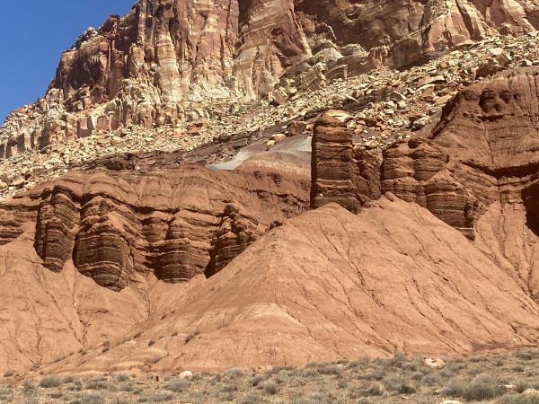
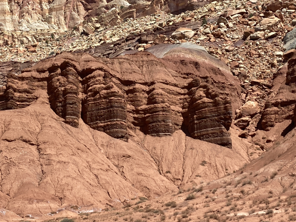
Look at this beauty.
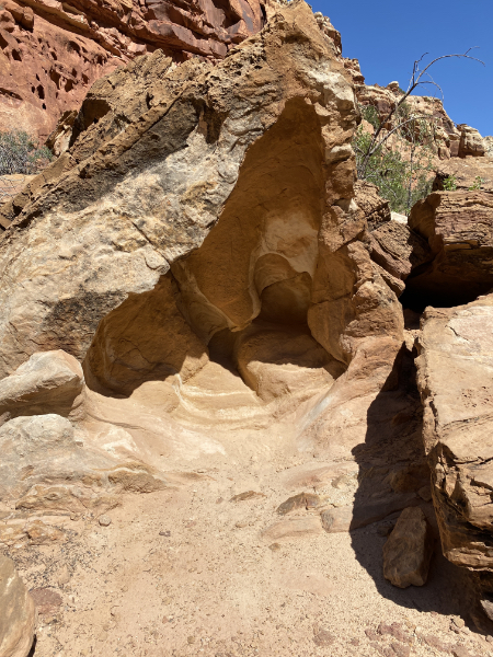
Now look at a close-up of it. If I hadn’t told you it was a close-up of a boulder along the path, would you not think it was a photo of an overhang on one of the cliffs?
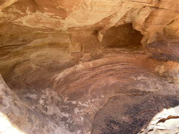
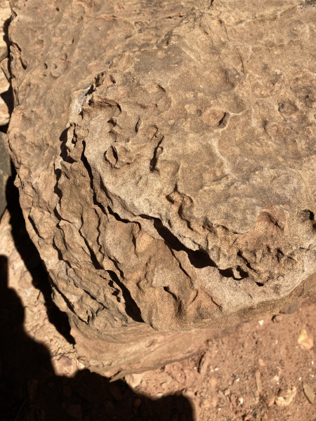
Pop quiz: Is this from a small eroded boulder next to the path, or is it a close-up of a cliff wall?
(Answer: It’s the same boulder as above.)
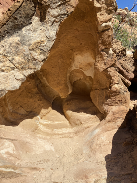
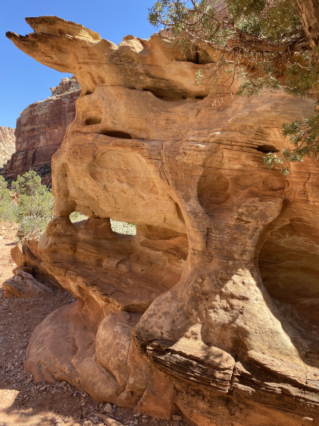
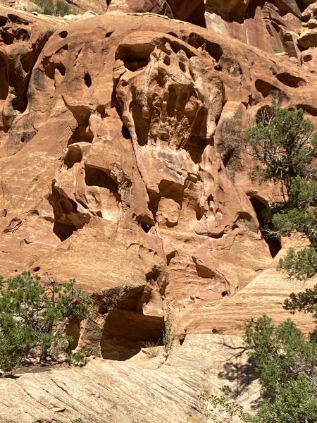
Fantastical is a word we don’t get to use very often.
Amazing.
This was on a face next to the path. You can see the the diagonal layers on the bottom, pushed up by tectonics from its original position, eroded flat, and a whole new generation of sediment laid down horizontally on top and then compressed into rock. Millions upon millions upon millions of years.
It’s worth mentioning, of course, that all the forces that created these spectacular landscapes here in Utah did the same thing — and are doing the same thing — where you live.
We met a friend.
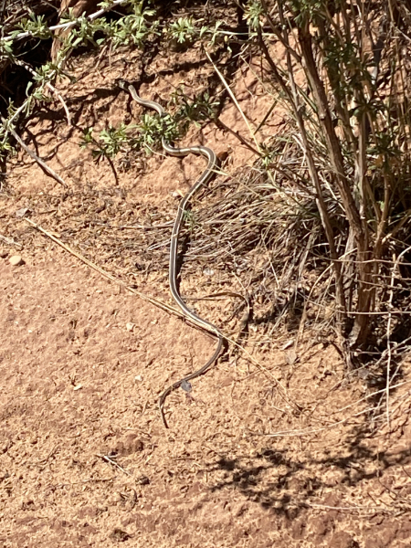
It’s about as big around as my finger, and about two feet long. It ignored us.
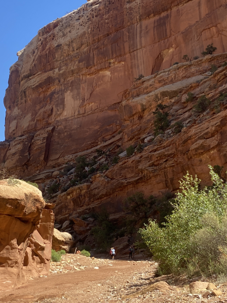
Most of these geology-focused photos are from our walk along the Great Wash. Here’s the point where we decided to turn back. Notice the humans for scale.
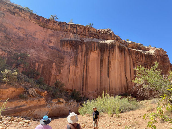
The streaks are from rain, with microbes and other beasties using that moisture to begin forming desert varnish.
Look at what the water in the occasional flash floods has done to this rock face.
Water finds cracks; water freezes; rock splits.
This was not always there.
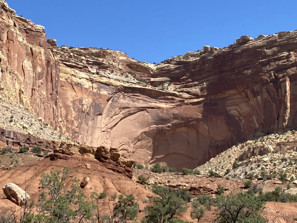
Wind and water on a macro scale. If this is a reef and not a plateau, then that amphitheatre will will eventually become an arch.
Those who are susceptible to pareidolia are certain to find a lot to make them wriggle with delight.
See that light-colored boulder on the left? See where it came from? It was an event.
So far, this area has the clearest delineation of the millions of years of layers from the different climates depositing silt into the ocean.
Like an iron oxide torte. (Iron is what gives the rock its red color; the gray sandstone was from an era where there was no oxygenation in the sea.)
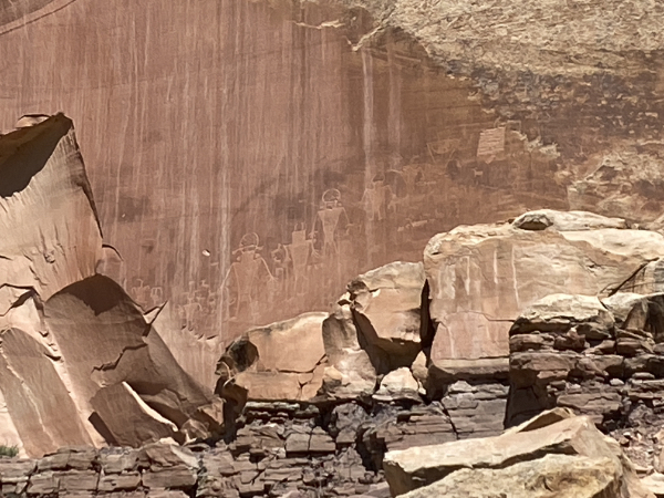
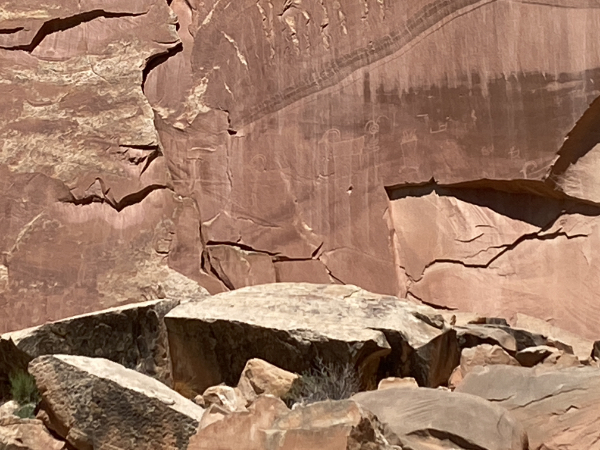
Another feature of Capitol Reef is the petroglyphs. They are high up a cliff face and are stunning. (See the chunk missing from the cliff on the lower left? That used to be part of the wall and had more petroglyphs on it, but it collapsed very recently, as in the past few decades. (I can’t remember the year and can’t find it online.)
The forces that formed this landscape are still in operation.
Cloudage.
A 360° panorama of Capitol Reef.
After the park, we returned to explore tiny little Torrey. A stop at the main gift shop was productive. I’ll do my usual swag post when we get home, but you should know that we purchased “I survived Hwy 12” t-shirts.
We also discovered the Robbers Roost Distillery (!) and Etta Place Cider. The Distillery is open only Thu–Sat, so they missed out on a large sale, but Etta Place was open.

We went in and had a tasting with the very entertaining owner, Ann, who was able to elucidate some of Utah’s weird-ass liquor laws. We condoled with her, explaining that Coweta County had just repealed Prohibition last year.
For dinner, we chose the Hunt & Gather restaurant, a “slow food” restaurant which — once again — confounded our expectations about what a town of less than 300 people can pull off. Amazing food, and of course they offered ciders and spirits from Etta Place and Robbers Roost.
Next: ARCHES NATIONAL PARK